
The most detailed and up-to-date U.S. parcel data with nationwide expansions into Canada.
When you need data that is attribute-rich, indexed-to-grid, and updated frequently, you need Whitestar ParcelsHD. Covering over 3,200 counties in the U.S., Whitestar Parcels provides 290+ attributes to simplify complex land-related queries, streamlining building and planning.
-
Benefit From Methodical Data Aggregation
Access current and accurate U.S. parcel data with standardized metadata, updated quarterly across counties.
-
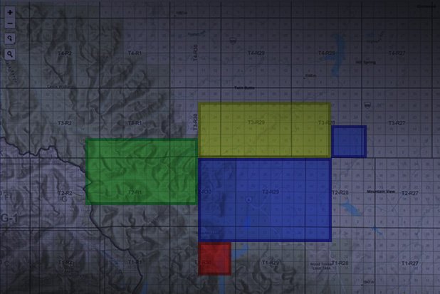
Gain Exclusive Ground Control
Enhance your land mapping using wide ground control with land base data reference, including Texas land grid, section-township-range, Carter townships, municipalities, civil townships, and tax districts.
-
Maximize Geocoded Data Efficiency
Improve analyses with geocoded parcel data, combining point location and address information.
-
Track Extensive Data Attributes
Track attribute and geography changes with quarterly-updated data, calculate acreage even for unreported county data, and support internal analytics with streamed geoprocessing.
-
Take Control of Your Data
Access, download, or stream parcel data in multiple formats, including Web Map Service (WMS), Web Feature Service (WFS), and Esri map and portal formats.
ParcelsHD
✔ Intended for infrastructure planning, engineering, and legal compliance
✔ 290+ attributes
✔ Precise measurements and details
✔ High usability with rich attributes
✔ Full legal description
✔ Spatially indexed to the TrueGRID layer

ParcelsHD+
✔ Intended for advanced planning with the most comprehensive land ownership data
✔ 350+ attributes
✔ Federal qualified opportunity zone
✔ Homestead and tax information
✔ Agricultural insights
✔ FEMA flood zone intelligence
✔ Land use and basic zoning
✔ And more

“Our rail network crosses a multitude of counties and parishes. We had been going to each one individually for adjacent parcel records — thousands of them, sometimes difficult to find, and some aren’t even online. ParcelsHD provides us with a custom extract of our network corridors, in one single contiguous geodatabase. The time and effort saved in data compilation is significant. We get our answers faster and those answers are the same across all departments. And I cannot overstate the convenience of having it all in one dataset.”
— ParcelsHD user
Harness hundreds of attributes tied to our parcel boundary maps.
-
Methodically collected and refined for more than 30 years, TrueGRID is the most accurate, foundational data layer used by hundreds of blue-chip companies.
-
Tackle any geospatial mapping project with our cartographic data library of more than 56 seamless, nationwide, base map information vector layers.
-
Add confidence to your decisions with our high-definition database of more than 4 million oil and gas wells in the United States, plus regulator records and adjusted locations to match TrueGRID.
All of this high-fidelity nationwide parcel data is part of our Whitestar Explorer solutions, with multiple plans designed to fit your unique needs. Find the Explorer plan that’s right for you.